

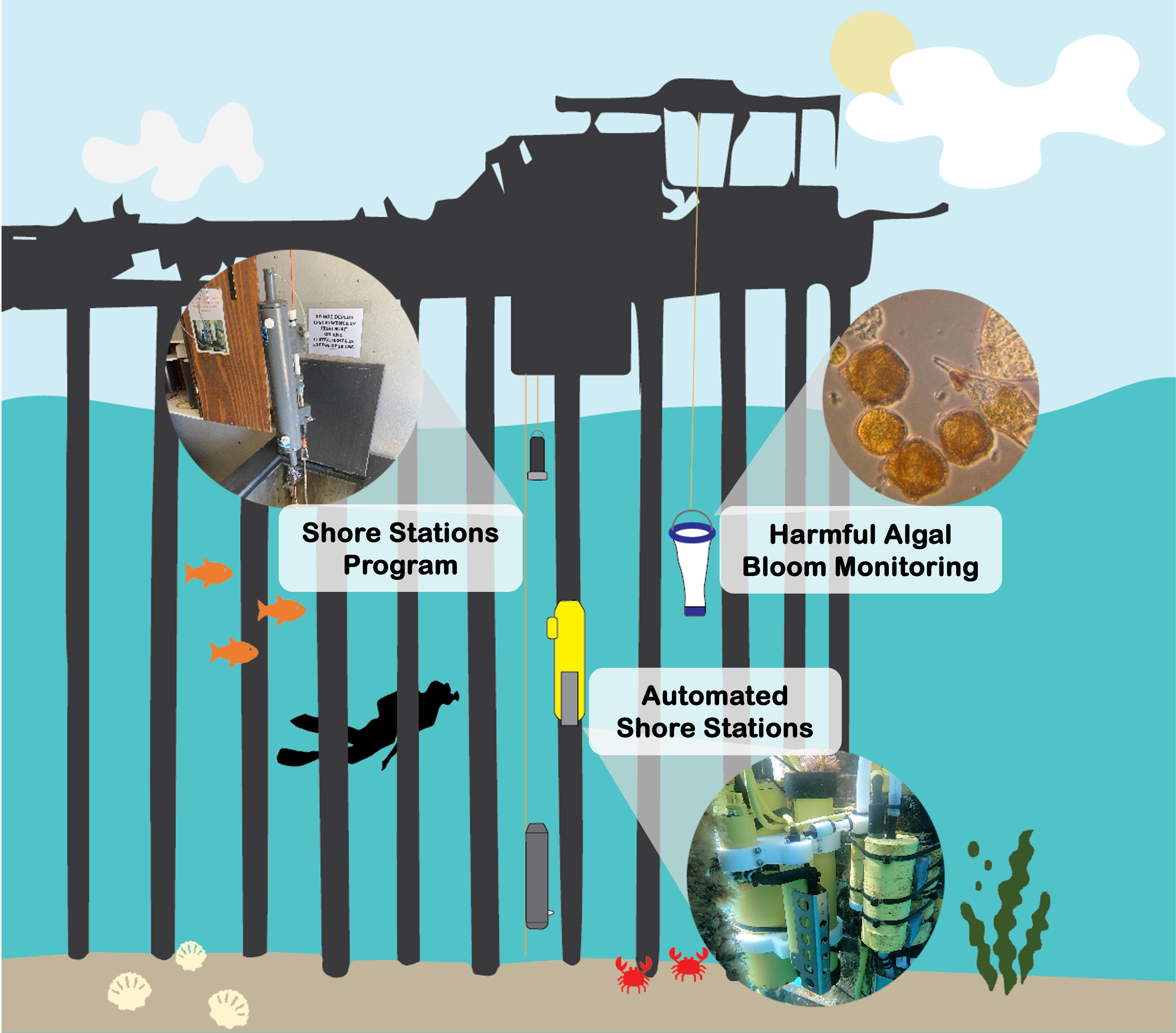
Shore Stations Program
The Shore Stations Program consists of 10 stations spanning the California coast where staff and volunteers manually record ocean temperature, with six stations also measuring salinity.
Daily temperature and salinity measurements started in 1916 at Scripps Institution of Oceanography soon after construction of the pier. These data are now the longest continuous measurements of their kind along the Pacific rim. Other stations were added early in the program. The Shore Stations Program is currently funded by the California Department of Parks and Recreation, Natural Resources Division.
Automated Shore Stations
The Automated Shore Stations network deploys and maintains oceanographic sensors at four pier locations in southern California. Continuous measurements include temperature, salinity, water depth, fluorescence, oxygen, and pH. Data collection began in 2005.
Stations in Southern California include: Scripps Pier, Newport Beach Pier, Santa Monica Pier, and Stearns Wharf Pier.
The Automated Shore Stations Program is funded as an integral part of the Southern California Coastal Ocean Observing System (SCCOOS), one of 11 regional contributors to the U.S. Integrated Ocean Observing System (IOOS). NOAA is the lead agency responsible for IOOS implementation and administration.
Harmful Algal Bloom Monitoring
The Coastal Ocean Observing Lab has been conducting weekly sampling as part of the Harmful Algal Bloom Monitoring Alert Program (California HABMAP) since 2008. The effort at SIO is one of nine locations reaching from Trinidad to La Jolla.
Measurements include HAB species, and other diatom and dinoflagellate species composition and abundance; sea surface temperature; chlorophyll-a; silicic acid; toxins; and nutrients including ammonium, nitrates, phosphates.
California HABMAP is a state-wide program funded by SCCOOS and CeNCOOS, providing timely updates on marine HAB events and understanding their timing, extent, and impacts on humans and the marine ecosystem.